

Cabox Is
Cabox is the name of the highest peak on the island of Newfoundland and an Aspiring Global Geopark spanning the Bay of Islands Ophiolite, Little Port island arc complex, and adjacent continental shelf and slope of Laurentia (i.e., proto North America). It rises to 814 meters (2670 ft) and is located on the Lewis Hills (named after a French Shore era King Louis), the most southerly of the four BOI Ophiolite Massifs, which also include the Blow Me Down Mountains, North Arms Hills/Gregory Mountains, and Tablelands in Gros Morne National Park, a UNESCO World Heritage Site. From offshore they appear as a series of “cabos”, or capes, originally formed between the Cambrian and Ordovician geologic periods during the closing of the Iapetus Ocean and formation of the Appalachian-Caledonian Mountains, then scultped by glaciers during the more recent Quaternary Ice Age. Centered in the lower Humber Valley/Bay of Islands region at the core of the Humber Arm Allochthon, the region exemplifies the Humber Zone of the Appalachian Orogen (as per Newfoundland geologist Harold “Hank” William’s 1978 Tectonic Lithofacies Map of the Appalachian Orogen) and is often referred to as the Galapagos of Plate Tectonics for the role it played in supporting the scientific theory of plate tectonics in the 1960s and 70s.
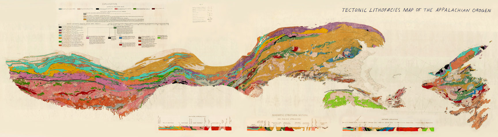
Original hand-colored Tectonic Lithofacies Map of the Appalachian Orogen by Harold “Hank” Williams & Jim Hibbard, 1976. The map features the “Humber Zone” (i.e., ancient continental margin of eastern North America) and is housed in the Corner Brook Museum in Western Newfoundland.
Geosites

Info Center

Trail Routes

Ode to Site B
